Trekking Mount Kilimandjaro Lemosho Route, 8 days

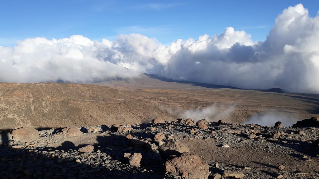
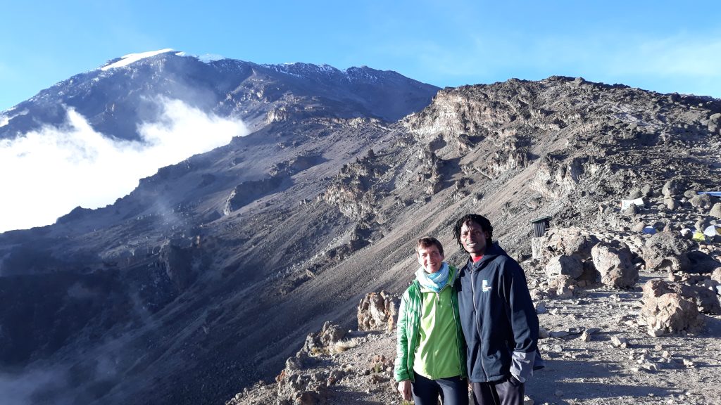
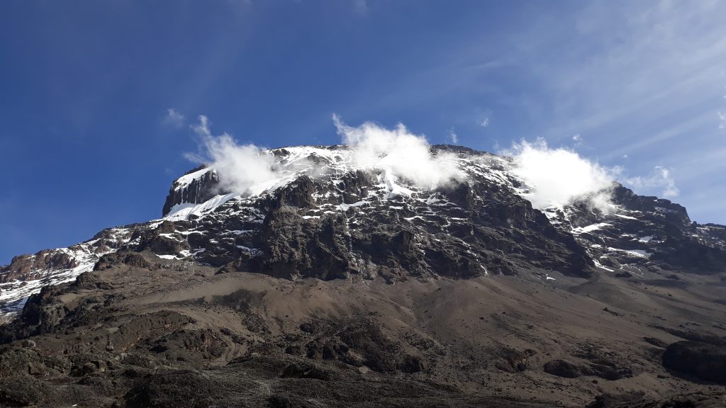
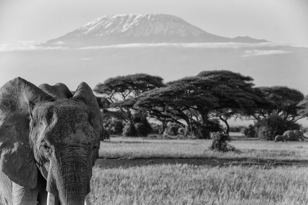
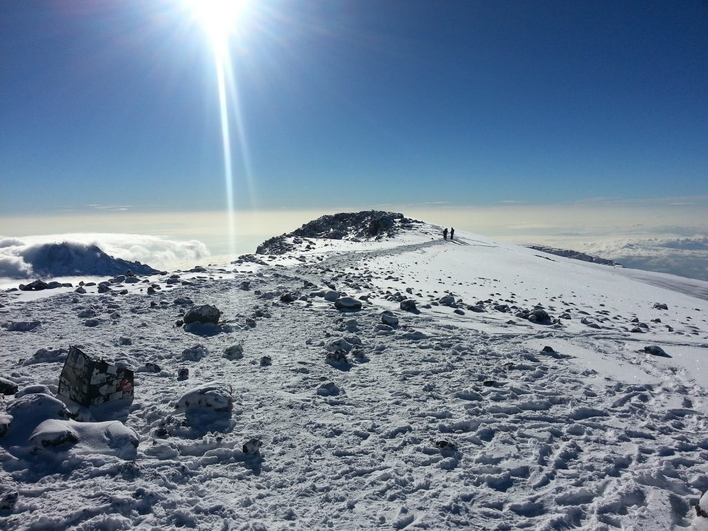
Located in Tanzania, Mount Kilimandjaro’s Uhuru Peak is the highest peak on the African continent at 5,895 meters or 19.340 feet. The majestic mountain massif is a glaciated, extinct volcano. The first climbers were Leipzig mountaineer, geographer and explorer Hans Meyer and Austrian alpinist Ludwig Purtscheller, who scaled the peak on October 6, 1889, with Muini Amani serving as the local guide.

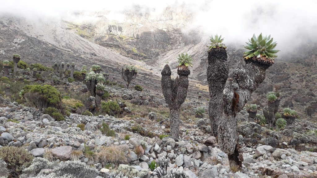
Kilimanjaro is popular with hikers because it is the easiest of the Seven Summits. Kilimandjaro is not only the highest peak in Africa, but also the highest freestanding mountain in the world.

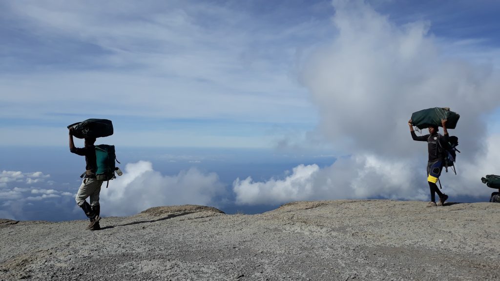
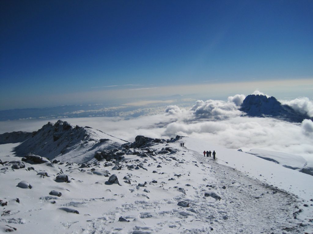
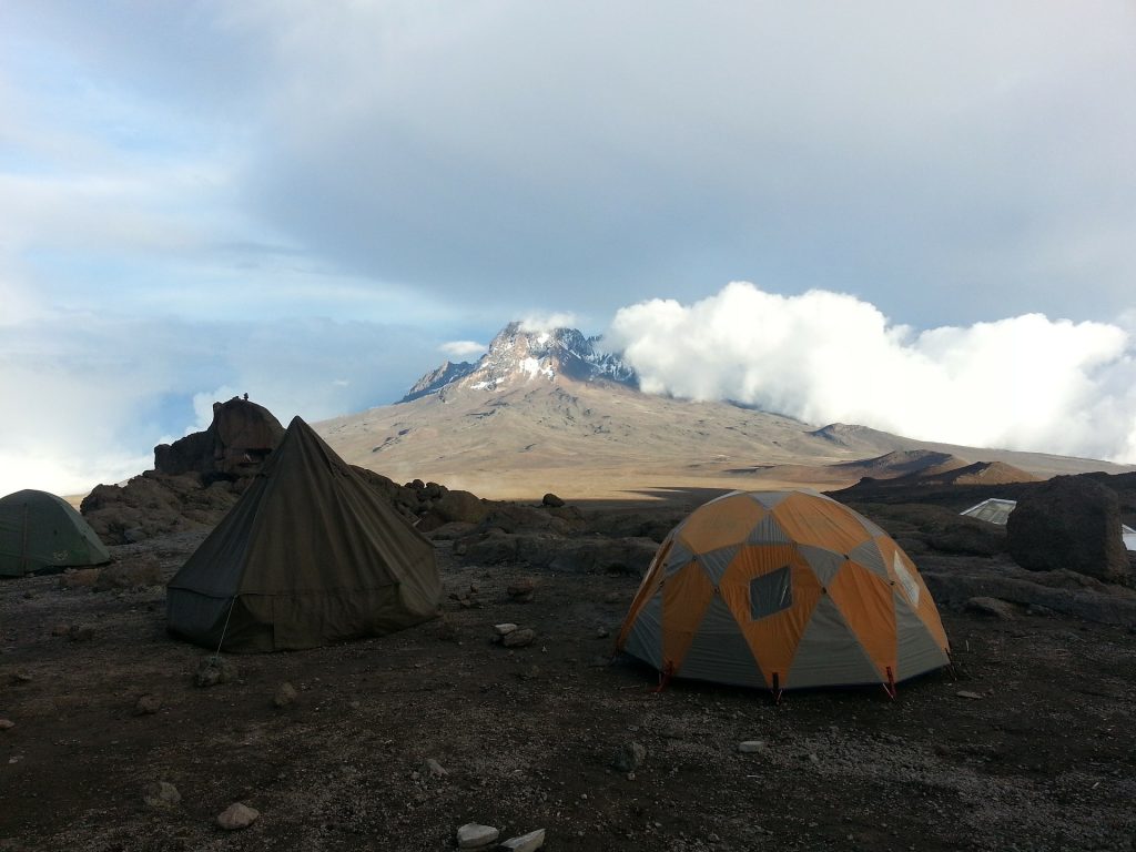
There are seven main routes across the Kilimanjaro massif to the summit, Uhuru Peak, one of which starts on the north side of the mountain and the rest on the south side. We now take you on the Lemosho route, which brings the highest probability of reaching the summit due to its long acclimatization period.

Day 1 LONDOROSSI GATE

At your accommodation in Arusha, you will meet with our professional mountain guide for a detailed discussion of all aspects of the climb and a check of your equipment. We leave Arusha town and drive to Londorossi Gate on Kilimanjaro, which takes about 2 hours. There we complete the park entrance formalities and meet our local porters who are an integral part of this trekking tour. We proceed to the start of the Lemosho route. After lunch, our path winds through an untouched, enchanting primary forest until we reach the first campsite.
Overnight: Forest camp, Distance: 6 km (3.7 miles), Walking time: 3-4 hours, Altitude: 2.400m – 2.900m (7.900ft – 9.500ft, Habitat: Rainforest

Day 2 WALDCAMP TO SHIRA-CAMP 1

We continue to follow the trail that leads out of the forest into the shrub zone covered with bearded lichen, and then into grasslands and volcanic rocks. As we ascend through lushly vegetated hills and cross several streams, we reach the Shira ridge before gently descending to Shiracamp 1. From here, there are excellent views of neighboring and nearby Mount Meru.

Overnight at Shiracamp 1, Distance: 8 km (4.9 miles), Walking time: 5-6 hours, Altitude: 2.900 m-3.500m (9.500ft – 11.480ft), Habitat: Heather

Day 3 SHIRA CAMP 1 - SHIRA 2 - MOIR HUT/CAMP.

During our gently ascending hike, we will explore the Shira Plateau throughout the day while heading east, getting closer and closer to the glaciated Kibo. Shira is one of the highest plateaus (3,500m – 3,960m or 11.480ft – 13.000ft) in the world.

 We cross the upper part of the shrub and heath landscape, passing through the Shira plateau and gaining altitude at a leisurely pace, making this route particularly suitable for acclimatization. Today we go up to Moir Hut Camp, an area framed amphietheater-like by the walls of the Lent Hills, where our route, so far quite solitary, joins the Machame Route.

 Overnight: Moir Hut Camp, distance: 14 km (8.7 miles), walking time: 5 to 7 hours, altitude range: 3,500m to 4,160m (11.480ft – 13.650ft)

 Habitat: heathland, high mountain desert

Day 4 CABANE MOIR - TOUR DE LAVE - CAMP BARRANCO

We leave the Shira Plateau and continue on a ridge in an easterly direction.


As we continue, our direction changes to the southeast, we head for the Lava Tower (4,570m or 15.000ft), a cooled volcanic vent also known as “Shark’s Tooth”. This is our highest elevation reached today. Continuing on, we come very close to the Arrow Glacier, over which there is a direct ascent to Kibo.


We descend to Barranco Camp at 3,900m or 12.800ft where we have dinner and spend the night. You can still walk around, and after the alpine desert of today, admire and enjoy the vegetation found here with its endemic species. Yes, we sleep lower today than last night, but this time is very important for the altitude adaptation of your body.


Overnight: Barranco Camp, distance: 7 km (4.3 miles), walking time: 4 to 6 hours, habitat: semi-desert.

Day 5 CAMP DE BARRANCO - CAMP DE KARANGA

On day 5, we leave the spectacularly located Barranco Camp and hike up a steep slope past the Barranco wall before continuing to the campsite in the Karanga Valley. This is a short day, ideal for acclimatization.

Overnight: Karanga Camp, Distance: 5 km (3.1 miles), Walking time: 4-5 hours, Habitat: Alpine Desert

Day 6 KARANGA CAMP - BARAFU CAMP

After breakfast, we leave Karanga and reach the junction that meets the Mweka trail, our descent route, and ascend to Barafu Hut (4,700m or 15.420ft). At this point you have completed the southern circuit, which shows the summit from many different angles. Here we set up camp, rest, have dinner and prepare for the night’s summit climb. The two peaks Kibo and Mawenzi are well visible at this place.

 Overnight: Barafu Camp, Distance: 4 km (2.4 miles), Walking time: 4-5 hours, Habitat: Alpine Desert

Day 7 BARAFU CAMP - UHURU PEAK (5.895m) - MWEKA HUT

Shortly after midnight (between 0:00 and 2:00) we continue our way to the summit between the Rebmann and Ratzel glaciers. We ascend over rough scree to Stella Point on the crater rim. This is the most mentally and physically difficult part of the trek. At Stella Point (5,740m or 18.830ft) we take a short rest and are rewarded with the sunrise after all the efforts (weather permitting). From Stella Point you may encounter snow on your one hour walk to the summit. At Uhuru Peak (5,895m or 19.340ft) you have reached the highest point of Kilimanjaro and Africa. Only the faster hikers will be lucky enough to see the sunrise from the summit. Soon we say goodbye to the roof of Africa and start our descent. We rest a bit at Barafu Camp and stay for lunch before descending to Mweka Hut campsite. Mweka camp is located in the high forest where fog or rain is expected in the late afternoon. On this day you will walk through several vegetation levels corresponding to different climatic zones.

Overnight: Mweka Hut camp, Distance: 12 km (7.4 miles), Hiking time: 7-10 hours summit-Barafu + 3 hours to Mweka camp, Habitat: Arctic to rainforest.

Jour 8 MWEKA - ARUSHA

After breakfast, descend through lush green rainforest to Mweka Gate (1,600m or 5.250ft) where you will be issued your summit certificates. At lower elevations it can be damp and muddy, so gaiters and trekking poles are helpful. You are most likely to wear shorts and T-shirts on this day, but you should carry rain gear and warmer clothing in your daypack. From Mweka, you will be transferred back to your accommodation in Arusha or to JRO airport.

Overnight: Arusha; Distance: 10 km (6.2 miles), Walking time: 3 to 4 hours, Habitat: Rainforest

Rates 8 days Mount Kilimanjaro trek Lemosho route

Our safaris that will amaze you

Safari 3 days / 2 nights

Tarangire – Manyara – Ngorongoro

Safari 4 days / 3 nights

Ngorongoro Crater and Serengeti

Safari 5 days / 4 nights

Tarangire – Serengeti – Ngorongoro